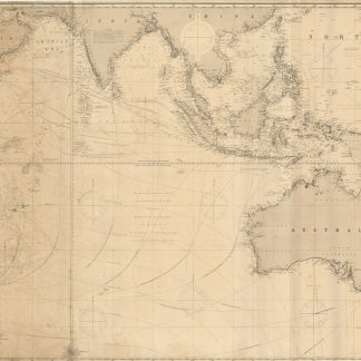
Two blank maps (coordinates only) for mapping the Celtic Sea.
Likely Britain, late 19th century.
Lithographed map grids, each sheet 760 x 558 mm, with central rosette.
€ 150.00
Two lithographed map grids, together covering an area between 46 and 52 degrees north latitude (printed) and 3 and 12 degrees west longitude (pencilled), in the Celtic Sea off the coast of Brittany and Cornwall. In one of the maps, various angles from a number of positions have been plotted with pencil, possibly indicating courses.
Brittle and browned, several repaired tears.