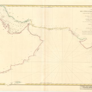
Carte des Cotes d'Arabie et de Perse.
Paris, 1840.
Engraved chart (87 x 59 cm), hand-coloured in outline.
€ 1,500.00
Chart of the Arabian Sea. From Eastern Arabia, the Gulf, the coast of Beluchistan to the Western coast of India.
References
Alai, Special maps E.294. Not in Al Ankary; Al-Qasimi.
Related
-

Voyage en Arabie & en d'autres Pays circonvoisins. Tome premier (-second). …Amsterdam & Utrecht, 1775-1780.
€ 6,000.00 -
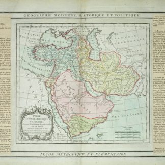
Perse, Turquie Asiatique et Arabie.Paris, 1799.
€ 450.00 -

Carte de l’Empire Ottoman comprenant les possessions de la Porte en Europe, …Paris, 1825.
€ 3,000.00 -
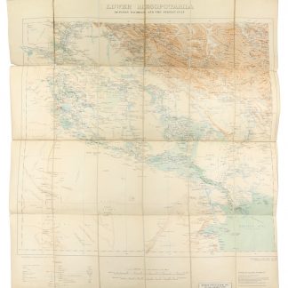
Lower Mesopotamia Between Baghdad and the Persian Gulf.London, 1917.
€ 1,500.00