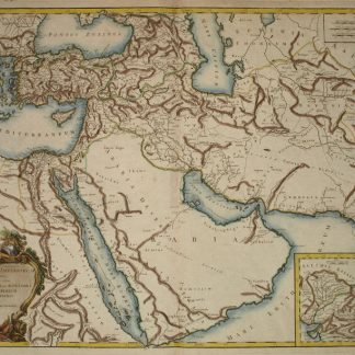
Antiquor[um] Imperiorum Tabula [...].
[Paris], Robert de Vaugondy, 1757.
Engraved map (73 x 52 cm), hand-coloured in outline.
€ 1,800.00
This finely engraved map, published in Vaugondy’s “Atlas Universel”, extends to the Caspian Sea in the north, in the west to show Greece, east to the Indus River, and south to include the Red Sea and the Nile River valley. Almost the whole of Arabia is blank and unexplored, but parts of Oman and the cities and places along the Arabian Gulf are indicated. In good condition.
References
National Maritime Museum Cat. I, 317. Al Ankary 185.
Related
-

Iran (Persia) and Iraq.London, 1930s.
€ 650.00 -
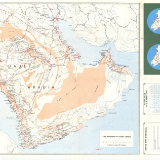
Saudi Arabian Road map.Dammam, early 1980s.
€ 1,000.00 -
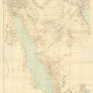
Arabia and the Persian Gulf. N.W. Section, S.W. Section. [Map of Arabia …Dehra Dun, 1916.
€ 8,500.00 -
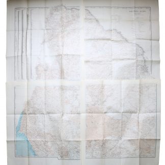
Northern Arabia according to the original investigations of Alois Musil …New York, 1926.
€ 3,500.00